
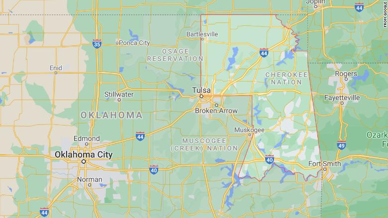
The Cherokee Nation’s reservation boundaries are now visible on Google Maps — an overdue acknowledgment of the tribal lands in Oklahoma.
“After the monumental US Supreme Court ruling in McGirt v Oklahoma, we’ve had many questions about our reservation boundaries, which always existed on paper maps,” said Cherokee Nation Principal Chief Chuck Hoskin Jr. in a Tuesday statement.
He was referencing the landmark July 2020 case in which the court upheld that lands promised to the Creek Nation remained an Indian reservation. “Now that our reservation is labeled on Google Maps, it’s easy for people around the world to search and see our reservation boundaries.”
The reservation boundaries include 7,000 miles nestled in northeastern Oklahoma. Borders for the Muscogee (Creek) Nation, Chickasaw, Choctaw and Seminole reservations — all in Oklahoma — have also been added in the last few weeks.
“In response to July’s Supreme Court decision, we’ve added labels and borders for the Muscogee (Creek) Nation, Cherokee, Chickasaw, Choctaw, and Seminole reservations to Google Maps,” a spokesperson for Google told CNN.
“It is an exciting step forward to be included on the map,” said Cherokee Nation citizen Joseph Erb in the statement. “This is a visual reminder that our nation is still here and a contemporary Indigenous nation of Continent.”
>>>details