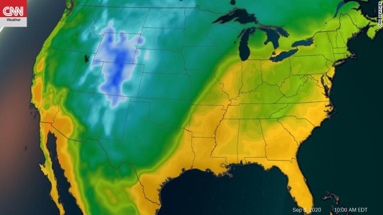
An early taste of winter with record cold temperatures and snow — yes, snow — is on the way for the Rocky Mountains.
A strong September cold front is set to drop out of Canada in the beginning of the week, making its presence known from the Dakotas all the way down to Texas by Wednesday.
This will bring a dramatic temperature swing to a large portion of the country as many deal with record-breaking, triple-digit heat over Labor Day weekend.
Nowhere is this temperature roller coaster more pronounced than in Denver, where a 60-degree drop in the city’s high temperature, from 99 degrees to 37 degrees, is expected in a mere 48 hours Sunday to Tuesday.
Such a front will bring a rare measurable snow to the Rockies. In fact, the higher elevations of the Rocky Mountains could pick up more than 8 inches of snow.
This would be one of the earliest first measurable snowfalls on record for the area, which typically doesn’t see the powder begin piling up until October.
Frost advisories and freeze warnings are also possible with temperatures settling some 40 degrees below normal in the Rockies, Plains, Midwest, and even parts of the South.
Meanwhile, excessive heat will continue to impact the East Coast and West Coast this week with little reprieve expected the next seven days.
Outlook for September
This upcoming week’s pattern reflects what September may bring.
The Climate Prediction Center (CPC) has released its outlook for the rest of the month. Forecasters are predicting warmer and drier-than-normal conditions across the West, a cooler-than-normal month across the north-central Plains, and a wetter-than-normal month across the south-central Plains and much of the eastern US.
One of the main indicators for the ongoing heat out West is the continuation of this summer’s weak monsoon, the CPC noted. The heat and dry conditions will only worsen the drought in the region, too.
September often brings a variety of weather conditions, including tropical activity, which peaks Sept. 10.
The CPC states this season’s hurricane outlook as a main driver behind the wetter-than-normal conditions for the east.
>>>>


